I think yesterday took more out of me than I thought. I slept heavy and drank 1.5 litres of San Pelligrino which didn’t see the other end. I woke with a bit of thick head too which was probably dehydration given I’d soaked up that much water.
The forecast was dry but it looked like a headwind. It would be an endurance test of my resolve today rather than elevation. I set off about 10am knowing it was probably going to be a long, hard day in the saddle again. I exited Oswestry through some non-descript housing estate to be met by a closed road where I needed to cross the A483. Luckily the workmen had barriered off access for pedestrians and cyclists so I was able to scoot through them. Into the lane opposite and it was traffic-free for a bit due to the closed exit. It was here though the wind was right in my face. That gusty, buffeting type thats not quite a gale but enough to slow you down and test your resolve. If it was going to be like this for the next 5+ hrs I needed to be mindful and not push too hard into it to blow up later.
The lanes from here to Shrewsbury were great. Wide, quiet and never straight. I lost my bearings. I stopped to take off my cape I’d opted to start with. I was a little too hot. I knew I was tracking the A5 and I could hear it in the distance but I could have been miles away from anywhere. It was pretty flat. Just the odd lump to contend with and the road surface, for seldom used roads, was pretty good.

I eventually crossed the A5 at Montford Bridge and began the trudge up the B4380 through Bicton. Its a wide, straight and painfully open piece of road (probably the old main road or A5) and I was having to grind away into a bloc headwind. Horrible. I turned off and dropped down to the park and river for some brief shelter. Beautiful park. I followed the NCR tracking the River Severn before popping out and heading out of town towards Atcham to cross the A5 but this time a big ass island on the dual carriageway. It may aswell be a motorway. No trouble here though but more grinding away into the headwind as I rode through Atcham before a right and into more lanes.

The Wrekin was looming in the distance and I knew the climb of the day was up a long drag on its southern side to Little Wenlock. I was tired now. The B&B had done me a packed lunch which I wanted but I told myself Ironbridge was the stop so I carried on. Incidentally I didn’t see a car in the lanes until I dropped into Ironbridge via Coalbrookdale. Great roads to ride.

I rode up to the bridge. Its covered in scaffolding while they fix it but you can still cross and they’ve created a separate walkway that hangs off the side so you can read up and view underneath to see what they are doing. I sat and ate my lunch. Loads of school kids about in groups being lead by their teachers. I overheard a teacher say if you look up underneath at a certain angle there is a face! Supposed to be true. Don’t know.


One thing I did notice is there are loads of pubs in Ironbridge!
I carried on out of Ironbridge and dropped on to NCR 45, the Severn Valley way. Its a bit like the Mawddach Trail. Old railway line, follows the river on hard packed ground. Its just a bit rougher and requires a bit of attention to avoid the pot holes. Nice change to tarmac though. This takes you into Bridgnorth. Another map plot error by me as I came into town. The NCR went right and my Garmin indicated left. I followed the Garmin and found I’d somehow found a path around a school field. Nah. I knew I was going to be on route 45 the other side of Bridgnorth so I just opted to follow the signs until I got back on route. I picked it back up in the low town and jumped on to the Chelmarsh road. I passed the NCR sign indicating right but me being a slave to my route again I carried on. A left turn came up. Private road. No through route. FFS!!! I checked my OS maps app and the NCR was just up the road but the OS map showed the route but no road. I’ve said before that NCR’s can vary from carpet-like tarmac to bridleways. This time it was the latter. I turned and dropped down some gravel single track and popped out with a nice view of Chelmarsh reservoir. The route rounded it before the last section around the other side got a bit silly in my opinion. It was no more than a footpath. A bit of gravel uphill and down the otherside, steep, gravel and a ford at the bottom. Quite dangerous if you weren’t very experienced or technical on a bike.


More lanes then a drop to Hampton Loade and onto the Mercian Way which is another traffic-free section of Route 45. Cool start as you traverse a couple of sections of boardwalk then its tight, twisty, up and down tarmac until you reach the Severn Valley Country Park. It runs right next to the railway line which would be cool if you caught a steam train trundling past. I crossed the bridge into the park and decided to go off-piste for a bit and head for Arley tearooms for a caffeine and sugar boost.


I demolished a coffee, bottle of coke and a piece of toffee fudge tray bake. The downside of dropping in to here was the 15% climb out of the village but it was worth it.
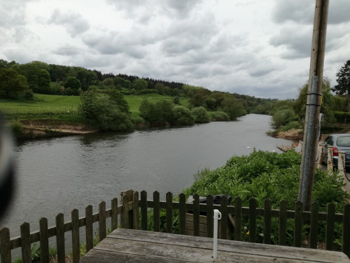
Now the coolest thing happened when I left. I took some pics of the river then two helicopter gunships turned onto the river, flew over me and the bridge and then slung a right. It was like something out of a film. I was lucky to film them as I had my phone out already. Awesome sight. See below.
The climb from the river is over a mile and my legs needed the sugar to kick in. I crossed the A442 and back into more familiar lanes from when I lived in Stourbridge which took me to the back of Kinver Edge. Into Wolverley and the traffic was picking up. After spending so many hours on my own with no cars about all week, its not nice to get cars speeding past.
I skirted Hagley and came across a swanky black Merc that had hit another car. Bonnet was all crumpled. Plenty of drivers rubber-necking. The airbag had gone off but everyone was out and walking about on their phones so no need to stop.
Belbroughton was full of cars as usual. I expected the climb up Broom Hill to hurt but the sugar was working now and I knew I’d be fine from now on. I’d just accepted the wind by now but was quite gusty on the run up to Bournheath. I considered stopping for a pint but opted to get home and get it done.
Last drag up through Catshill done and so was I.
Its been a great week with highs and lows both on the road and physically and emotionally. I’m quite chuffed a got through it. It was harder than I expected and over terrain I should have double checked. Wednesday was my low-point. I was smashed to bits. I was so tired I was feeling really down and pessimistic for the rest of the trip but a hot bath, food and sleep, the key ingredients for a good recovery and I was back up again the next day ready to go. I’d definitely do it again. I think I packed well, I just missed some overshoes for when it rained but that was it other than my garmin charging cable!! I think I’d be more careful with the route next time but everything else was spot on.
So who is going to have a go next?
Some stats for the week. As my Garmin played up and Strava reported wrong on some days I’ll base my data on my OS Maps route data which I would guess would be accurate anyway.
Days – 6, 5 nights
Distance ridden – 560km approx (347 miles)
Hours in the saddle – 26 h 35 min approx
Elevation – 12,250m approx (40,200 ft)
Weight of bike – 38-40lbs approx, kit weight, 20lbs approx
Thanks for reading this week. I do my blogs instead of reading a book and as a diary or journal. Its nice to know people take an interest.
I hope I’ve inspired you to think about having a go yourself. Just plan ahead!


One thought on “Tour Day 6 – Report card”